 Discovery of fossils, tools, coins, and remains of ancient archaeological sites give enough historic evidence about Soan civilization and its continuity in Potohar (or Potwar) Plateau. The people, colourful landscape, lakes, hill ranges, flora and fauna are sufficient reasons to explore the land that is largely off the beaten track and one does not see many backpackers in the area.
Some of the world history has started from this region. The first residents of the land we now call home were Stone Age people in the Potwar Plateau. They were followed by the more urbane Indus Valley (or Harappan) civilisation which flourished between the twenty-third to eighteenth centuries BC.
Some of the earliest relics of Stone Age in the world have been found in the Potohar region, with a probable antiquity of about 500,000 years. The crude stone implements recovered from the terraces of the Soan carry the account of human grind and endeavours in this part of the world to the inter-glacial period. The Stone Age men produced their equipment in a sufficiently homogenous way to justify their grouping in terms of a culture called the Soan Culture. Around 3000 BC, small village communities developed in the Potohar area and began to take the first hesitant steps towards the formation of society.
Bounded on the east by the River Jhelum, on the west by the Indus, on the north by the Kala Chitta Range and the Margalla Hills, and on the south by the Salt Range, Potohar Plateau is really undulating, multi-coloured, picturesque and geographically ill defined area. The diverse wildlife like urial, chinkara, chukor, hare, porcupine, mongoose, wild boar, and yellow throated martin, add colour to the beauty of the area.
 Sadly, due to low rain fall, extensive deforestation, coal mining and oil and gas exploration, the Valley is becoming devoid of vegetation. The under water areas of lakes (Uchali, Khabeki and Jhallar and scenic Kallar Kahar) have reduced to much smaller areas than in the past. Experts say that the lakes have been here for at least 400 years. Locals tell about a strange phenomenon that was observed over Ucchali Lake in 1982. A very broad and distinct rainbow appeared over the horizon of Ucchali and was seen continuously for 15 days. No scientific explanation of this has been given so far, but the locals think that the rainbow appeared because of a volcano hidden under the lakes. They also tell that because of the hidden volcano the water of the Lake keep changing colour.
Kallar Kahar is famous family picnic spot. It is surely one of the most scenic places in the country. There is a shrine of the saint where peacocks dance and people who 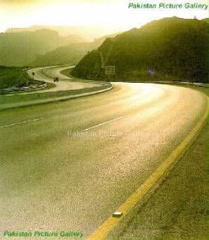 visit the shrine see them. But Kallar Kahar Interchange on the Motorway is turning the Lake into a typical bus ‘adda.’
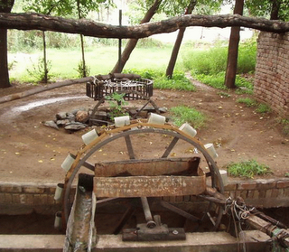
Dhan Valley, commonly called Dhan Kahon, is the middle segment of the ancient Potohar Plateau. The contemporary city of Chakwal in the Dhan Kahon is relatively new. Chako Khan of Maer Minhas tribe founded it in the period of Mughal Emperor Zaheer ud Din Babur. Chakwal was created as an independent district of Rawalpindi division in 1985 by combining subdivision Chakwal of district Jhelum, subdivision Talagang of district Attock and a part of Choa Saidan Shah, carved out of subdivision Pind Dadan Khan, district Jhelum. The geography and environs make Chakwal a predominantly rural district pivoted on an arid agrarian economy. The economy in the area is fast changing though – drifting from agrarian to industrial. The Dhan Kahon is becoming industrial and Chakwal is emerging as an Industrial town of the future. Completion of Motorway passing near Chakwal has expedited the process.
Dhan Kahon is an arid area and the terrain is mainly hilly, covered with scrub forest in the southwest, and levelled plains inter-spaced with dry rocky patches in the north and northeast. The tribes, clans and castes that inhabit this area – some of them may be indigenous people – are the Awans, Rajputs, Mehr, Kahuts, Mughals, Gujars, Gondals, Arains and the Sheikhs. The physical features of the area, its tribes, its society and its economy all combine to make Chakwal one of the main recruiting areas for the armed forces.

 There is a famous saying that every second person of area is a soldier (and every third one is a poet). The only option available to the spirited and rugged people of the area famous for martial traditions was service in the armed forces. An actual artillery gun — awarded to a valiant soldier Subedar Gul Muhammad of Dulmial in the First World War – mounted on a platform in front of his village is testimony to the fact. The gun is one of the only two such awards in the world.
Chakwal town have evolved over time without deliberate planning depending on the need and situation suited to fulfil the ordinary requirements of living. Like Bannu, Kohat and Mianwali towns, in bazaars of Chakwal one finds chukor or quails hanging in cages on every second shop. Or you see people fondly taming the quails for the next fight.
The old parts of residential area of Chakwal consist of two or more storied houses on both sides of narrows, undulating, paved pedestrian streets, with their walls common with other houses on three sides. The houses mostly do not have any lawns, but internal courtyards do exist, and roof-tops are utilized for sleeping in the summer. However, the houses belonging to the upper and upper-middle classes are modern bungalow type with lawns and peripheral walls. Construction of spanking new houses is priority one for the people employed abroad.
There is a good road network in the area. You can turn to Chakwal from the Grand Trunk Road either at Sohawa or from Mandra or you get to the town from Sargodha.  Mandra-Chakwal-Bhun railway that was brought into this mineral rich area in 1922 has been closed though. A big blunder!
Different items from railway stations en route have been taken away. It could have been useful to keep this track operational for petroleum industry which is passing through primary and experimental phase and other minerals like coal, salt, gypsum, lime stone and fine construction stone found in the area. Right now Pakistani experts are carrying out extensive exploration of oil and gas. This railway track could become very vital if Kalabagh Dam is constructed and Attock-Jand-Injra railway track is encroached. In that case Mandra-Chakwal-Bhun route could be extended up to Injra as it was originally planned. The rail route also had a strategic importance due to an air force installation in the vicinity.
Chakwal is famous for many things: bulls, ground nuts, golden ‘Ar’ work on chappal (sandals), and fast growing cotton industry, brick kiln industry, clay pots and sweets commonly known as rewaryan. Found of cockfight, quail fight and dog fights, chakwalians organize annual horse and cattle show where people of the area gather to enjoy horse races, hunting dog races and other local sports in addition to parading and trading of fine quality animals.


The CBD amassment – relaxing gummies for adults offers a assortment of formats that please singular preferences, and each a certain feels well executed. The lubricant appears dry-clean and accordance, the packaging materials feel long-lasting, and the layout is simple besides elegant. The products are quiet to inventory and treks with, thanks to obvious lids and aphoristic sizing. Entire, the label delivers a outstanding and carefully crafted experience without unrequired extras.
This is very much informative. I like it
Wonderful work!
Very informative indeed!
I wonder if it is correct to include Chakwal into Pothohar region!
I ve personally witnessed a marked difference in the dialect,customs,traditions,habits,attitude&life-style of the “pothoharites&the”Chakwalites.