I must have passed by this place countless times on my way to Abbottabad and back, and was always intrigued by its name. Khota Qabar! Donkey’s grave, that is. Why, I wondered, so much reverence for a dead donkey?
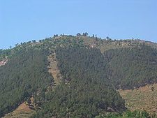

Khota Qabar lies on the Karakoram Highway, about 60 miles north of Islamabad and 7 miles short of Abbottabad. It is precisely where the road starts climbing into the mountains of Mansehra and beyond, into the picturesque Kaghan valley and the Northern Areas. I always knew it as a place where truck drivers coming up from the planes stopped to let their engines cool down, and to top up the radiators with cold water from a nearby stream, to ready their vehicles for the climb ahead. Because of the presence of trucks, several khoka restaurants have sprouted at the spot and are doing a brisk business.
Khota Qabar is so small a place that you won’t find it on any map of Pakistan. However, to my pleasant surprise, a Google search turned up the following information on the place: latitude 34.09; longitude 73.17; elevation 3,251 feet. I was impressed — with Google.